The Best Things to Do in Jujuy, Argentina: Explore This Underrated Province in Argentina
In the extreme northwest portion of Argentina, you’ll find the province of Jujuy. It’s bordered by Chile, Bolivia, as well as Argentina’s own Salta Province, and Robin and Arlene Karpan have put forth the ultimate guide, with the goal of letting travellers know that it’s well worth the effort to get here and explore!

Serranía de Hornocal. Photo Credit; Robin & Arlene Karpan
Jujuy occupies the extreme northwest corner of Argentina, in South America. It’s one of the country’s smaller provinces in size but it pulls way more than its weight when it comes to amazing natural attractions. If we were to use one word to describe the region, it would be colour.
The centrepiece is the Quebrada de Humahuaca stretching along the Rio Grande River, a UNESCO World Heritage Site recognized for both its stunning landscapes of wildly colourful mountain slopes and cultural heritage dating back to pre-Inca times.
Jujuy is also one of the most culturally diverse parts of Argentina, with many residents of Indigenous descent. Wandering through the craft markets of the region, you’ll notice a lot of artwork having similarities to neighbouring Bolivia.
Getting to (& Around) the Province of Jujuy

Questa de Lipan. Photo Credit: Robin & Arlene Karpan
San Salvador de Jujuy, in the southern part of the province, is the capital city and main transport hub. While you can fly here from Buenos Aires, many travellers, ourselves included, opt to fly to Salta instead. Salta is only slightly farther away from the Quebrada de Humahuaca than San Salvador but is a much more interesting city, and a convenient jumping-off point to explore both Salta Province and Jujuy.
We took buses around the region and organized excursions for daytrips. It was about four hours by bus from Salta to Tilcara, where we made our main base. From there it was easy to take buses to the other main towns in the region, including Purmamarca to the south and Humahuaca to the north.
Getting a rental car is certainly another option, providing more flexibility. But parking can sometimes be an issue in colonial towns which weren’t designed with cars in mind, and not all accommodation provides parking.
*Please note that this post contains affiliate links. Simply put, this means that we may receive a small commission for our honest and heartfelt recommendations, at no additional cost to you.
What to Do in Tilcara
We chose the town of Tilcara as a base for exploring the region because of its central location, range of accommodation, and the number of nearby attractions. Like other towns in the area, Tilcara sits in the narrow valley of the Rio Grande River, bordered by mountains on either side. Not just your regular run-of-the-mill mountains, but slopes with colours so brilliant that you wonder if they have been splashed with paint. We never tired of just gazing over the scene.
We had the perfect gazing spot right from our accommodation at Tinku, a small guest house on the edge of town where the front patio looks over the dazzling landscape. A bonus is that all rooms are complete apartments and come with breakfast each morning. Just behind, a short but steep trail leads up to a hilltop with a cross where an uninterrupted 360-degree view awaits.
Explore the Ruins of Pucará

The gorgeous ruins of Pucara. Photo Credit: Robin & Arlene Karpan
Tilcara is thought to be one of the oldest centres of human habitation in Argentina, dating back over 10,000 years. Archaeological sites exist throughout the region, with the most accessible being the ancient fortified pre-Inca community of Pucará on a hillside on the edge of Tilcara. It was thought to have been first occupied around the 12th century AD and was chosen for its hilltop position that would be easier to defend.
Much of the site has been restored where we can wander through some of the small stone rooms and enclosures. The location alone is worth the visit, with the fortification surrounded by huge cardon cacti, and a backdrop of the Rio Grande Valley and red mountains beyond. Your site admission ticket is also good for the Archaeology Museum in town which displays many artifacts found here.
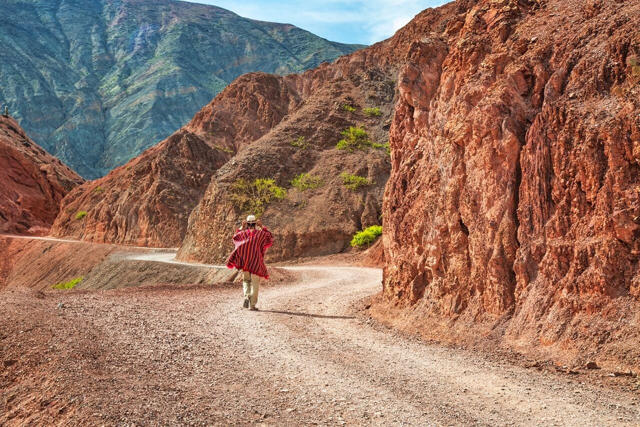
Hike to the Garganta de Diablo and Waterfall

Arlene enjoying the picturesque waterfall. Photo Credit: Robin & Arlene Karpan
High into the hills behind Tilcara, along the Huasamayo River and gorge, lies the Garganta del Diablo – the Devil’s Throat. You can get there along a hiking trail from the edge of town or, as we did, take a taxi to the top and then walk the trail back to town. There’s still a lot of walking to do once you arrive at the site which has been preserved as a park. A short path leads down into the steep narrow canyon which has been likened to the throat of the Devil.
A longer walk heads further up the canyon to a nice waterfall, where you have to jump across a shallow rushing stream a few times as you follow the route. We enjoyed the waterfall hike more than the Garganta itself. It was an easy and pleasant walk back to town along the rocky hiking trail that offered non-stop views. We were glad to be going down rather than up judging by the amount of huffing and puffing from people we met heading up.
Visit Maimará and the Painter’s Palette
Maimará is a sleepy town just five kilometres from Tilcara along the main highway through the valley. The mountain slopes overlooking it are known as the Painter’s Palette because of the crazy array of colours in the rocks. A trail heads partway up into the hills, ending at a religious cairn overlooking the valley. Despite the amazing scenery, this doesn’t seem to be a well-visited spot.
We were the only ones on the trail when we went. You can get to Maimará by taking any bus heading south from Tilcara. Or take route taxis (ordinary cars taking up to four passengers) which make the run between Tilcara and Maimará for about the same price as the bus (less than a dollar).
Check out Purmamarca and the Cerro de 7 Colores
Just when we thought that we had seen the most spectacular mountains, Purmamarca took things to another level. This small town with low adobe buildings and a whitewashed church dating to 1648, lies about 25 kilometres south of Tilcara. Its prime attraction is the Cerro de 7 Colores or the Hill of 7 Colours.
In reality, there is more than one hill and more than seven colours – everything from dark green to purple, pink, fire-engine red, and everything in between. The name comes from an age-old legend where the children of the village decided that they wanted somewhere more exciting to live. So each night they snuck out of their beds and painted the hills a different colour. They did this for seven nights, leaving us with the scene we see today. Scientists have more mundane explanations involving the accumulation of sediments from different geological periods spanning 600 million years.
A 3-kilometre road and walking trail called the Paseo de Los Colorados winds through the most dazzling parts of the landscape. Besides the scenery, Purmamarca has an active craft market and offers the chance to try some local foods such as llama sausage. Unlike other towns in the valley, Purmamarca is primarily a tourist town where accommodation often has to be arranged farther in advance and prices are higher.
We found it just as easy to visit by taking one of the frequent buses from Tilcara. Guided tours to Purmamarca operate from other towns but they tend to arrive in the middle of the afternoon, during the worst possible light for photography, and not stay very long. Going on your own is easy and straightforward.
Take an Excursion to Salinas Grandes
One place where we did take a guided trip was to the Salinas Grandes, high into the mountains west of Purmamarca, just across the border into Salta Province.
There were only four of us, along with our driver/guide, so it was almost like a private tour. Half the fun is just getting there, as the road follows the colourful valley of the Rio de la Quebrada de Purmamarca before heading up the mountain slopes on the Questa de Lipan, a zigzagging route of hairpin turns eventually crossing the mountain pass at 4,170 metres. Storm clouds shrouded the pass and we got a few snowflakes, even though it was mid-summer.
The Salinas Grandes is a massive expanse of salt flats covering 525 square kilometres at 3,450 metres altitude. It’s a mesmerizing sight as we walk across the vast crystallized surface with its strange hexagonal shapes. There is a small salt extraction industry here, but for the most part it is a tourist attraction where people come to experience the phenomenon and take perspective-altering photos which are easy to do because of the vastness of the place.
Set Eyes on Humahuaca

Humahauca, the largest town in the region. Photo Credit: Robin & Arlene Karpan
Another day, we arranged for an organized excursion to the Serrania de Hornocal (next section) with stops in Humahauca, the largest town in the region, and a couple of other interesting places along the way. One is the Tropic of Capricorn where a cairn marks 23°27′ latitude and we officially enter the Tropics.
Not far past is the tiny town of Uquia, where just outside lies the Quebrada de las Senoritas, yet another surprising and vibrant canyon. Here the rocks are mostly blood red and orange, in places looking as if dripping mud had been hardened and then painted red. While just as amazing as some of the other spots in the region, it doesn’t get as many visitors. Uquia is only seven kilometres south of Humahuaca along the main highway, with several buses per day passing by.
Humahuaca is a lively colonial town with narrow cobblestone streets and a long history dating to the Argentine War of Independence and thousands of years farther back to when this was part of a major trade route. The Monument to Heroes of Independence dominates the town, its elaborate bronze statues and artwork dedicated to the northern army that was crucial in the fight for independence from Spain.
An interesting ritual has been taking place for years in the town centre at precisely noon. When the clock in the clock tower strikes 12:00 a door opens and an automated statue of San Francisco emerges, who raises his hands and cross to bless the gathered crowd.
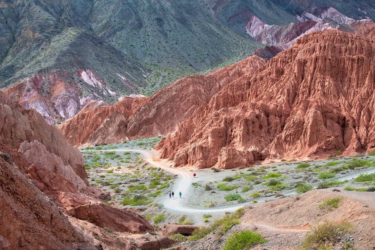
Make Time for Serrania de Hornocal

The road to Hornocal. Photo Credit: Robin & Arlene Karpan
One of the top reasons to visit Humahauca is to see the Serrania de Hornocal, about 25 kilometres east. It’s also sometimes referred to as the Hill of 14 Colours. While not a long distance away, the road winds through a tortuous series of hairpin turns until we reach 4,350 metres. Along the way we see wild vicunas grazing beside the road.
The Hornocal is one of those surprising places where you discover that photos you have already seen, no matter how good, can never do justice to the real thing. It’s simply astounding, looking more like an abstract painting than mountain slopes. The mix of colours is caused by various minerals in the rock and the result of millions of years of eroding deposits from different geologic eras.
The easiest way to visit is on an organized excursion, with most running from nearby Humahuaca, though they also operate from other towns, including from as far away as Salta. We took a trip starting from Tilcara, where we were staying. There are excellent views from the parking area.
Another path goes downhill to a closer viewpoint, but signs warn about walking too far at this altitude. As it turned out, the weather decided for us. Storm clouds were rolling in and we could see that the entire scene could soon disappear. We used what little time we had to photograph right from the parking lot. A few minutes later clouds blocked the view and we were engulfed in a deluge of ice-cold rain.
Travel the Province of Jujuy With Intention

The Quebrada-de-las-Senoritas. Photo Credit: Robin & Arlene Karpan
While becoming more popular as a destination, Jujuy still tends to be a bit more off-the-beaten-path for foreign visitors to Argentina, but this turned out to be one of our favourite parts of the country.